GCE-LTER Project News
January 2026 CalendarMultispec Flight New or Updated Publications01/05/2026 –
Jiang, R., Liu, W. and Pennings, S.C. 2025. Global warming disrupts the relative allocation between sexual and clonal reproduction in a common salt marsh plant. 106:e70101. (DOI: https://doi.org/10.1002/ecy.70101) 01/05/2026 –
Lugar, K. and Pennings, S.C. 2025. Effects of large mammal herbivory on salt marsh invertebrate communities vary with grazing type. Estuaries and Coasts. 48:105. (DOI: 10.1007/s12237-025-01544-x) Latest Data Releases11/25/2025 – Data Revision
The data set "Long-term water quality monitoring in the Altamaha River near Doctortown, Georgia" (https://gce-lter.marsci.uga.edu/public/app/dataset_details.asp?accession=NUT-GCEM-1909) was revised to correct data reported in incorrect units. Nitrate concentrations were mistakenly reported in parts per million (ppm) instead of parts per billion (ppb) for samples taken between November 2019 and December 2022. These data have been converted to the correct units and have been republished. 08/26/2024 – Data Release
Data sets PLT-GCEM-2012 "Long-term monitoring of seven high marsh plant mixtures on Sapelo Island GA" and PLT-GCEM-1309 "Annual monitoring of high marsh plots dominated by Juncus and Borrichia" have been updated to include recent data. 07/29/2024 – Data Release
Data set titled 'Percent cover measurements of four site-dominant species from the GCE-LTER Seawater Addition Long-Term Experiment (SALTEx) Project' was added to the GCE data catalog. You can view the data here: PLT-GCED-2404. Abstract: SALTEx (Seawater Addition Long-Term Experiment) is a field experiment designed to simulate saltwater intrusion in a tidal freshwater wetland to predict how chronic (Press) and acute (Pulse) salinization will affect this and other tidal freshwater ecosystems. The SALTEx experiment was initiated in 2012 and consists of 31 field plots, each 2.5 m on a side. There are three treatments (Press, Pulse, and Fresh) and two types of controls (with and without sides), each consisting of six replicates. The Press treatment plots receive regular (4 times each week) additions of a mixture of seawater and fresh river water. Pulse plots receive the same mixture of seawater and river water during September and October, which is historically a time of low flow in the river when natural saltwater intrusion occurs. The Fresh treatment plots receive regular additions of fresh river water. Treatment water is added during low tide to facilitate its infiltration into the soil, and all plots are inundated by astronomical tides at high tide. Percent cover was measured for four site-dominant species (Zizaniopsis miliacea, Pontederia cordata, Persicaria hydropiperoides, and Ludwigia repens) each July from 2013 to 2022. Citation: Craft, Christopher B. 2024. Percent cover measurements of four site-dominant species from the GCE-LTER Seawater Addition Long-Term Experiment (SALTEx) Project. Georgia Coastal Ecosystems LTER Project, University of Georgia, Long Term Ecological Research Network. http://dx.doi.org/10.6073/pasta/554fbb232ea0ae95144f0857a604e73c Latest File Uploads12/11/2025 – Spreadsheet (GCE only) 11/18/2025 – Other (GCE only) 11/18/2025 – Other (GCE only) |
GCE Project Announcements01/21/2026 – Announcement
We're now accepting applications for intern positions for 2026. Please encourage interested undergraduates to apply. https://gce-lter.marsci.uga.edu/public/employment/summer_internships.asp (contact Steve Pennings for additional information) 01/05/2026 – Meeting
We had a great showing of GCE folks at the annual AGU Fall Meeting in New Orleans, December 15-19, 2025 (contact Steve Pennings for additional information)12/17/2025 – Monitoring Program
Surface Elevation Table measurements from 8 of the 9 marsh monitoring sites took place 14-16 December 2025. The UNCW crew was supported by the outstanding support of LTER Technicians Emily Pace and CJ Sides under the guidance of John Williams. (contact Lori Sutter for additional information)12/10/2025 – Meeting
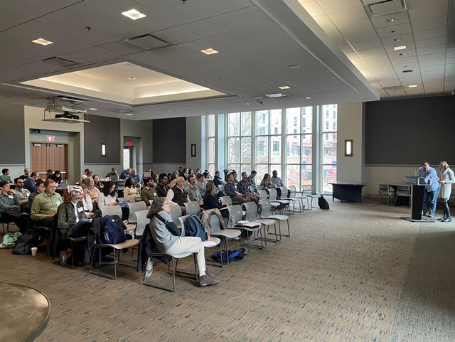
The GCE annual meeting on December 8 and 9 at UGA marked the transition from GCE IV to GCE V. We heard summaries of lots of GCE IV research and reports from the beginnings of GCE V research. And lots of discussion and planning for the coming year. (contact Steve Pennings for additional information)12/05/2025 – Field Program News
The field crew recently obtained a used 2020 Carryall 500. This utility vehicle replaces an aging Kawasaki Mule that is used by technicians, graduate students, and interns to access field sites. The aluminum parts utilized on the Carryall should contribute to a longer lifespan compared to the rust-prone steel Mules. (contact John Williams for additional information)11/15/2025 – Conference News
Lots of GCE scientists presented at the CERF 2025 conference. I've only got photos of the Pennings lab... (contact Steve Pennings for additional information)» Add Announcement or Update Announcement (GCE only) » Subscribe to the GCENEWS-L Email List (weekly GCE newsletter) » View/Search Recent GCE Announcements |


